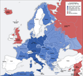
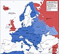
চিত্ৰ:Second world war europe 1941-1942 map en.png

এই পৃষ্ঠাৰ সমল অন্য ভাষাত সমৰ্থিত নহয়।
অসমীয়া ৱিকিপিডিয়াৰ পৰা

মূল ফাইল(1,090 × 1,000 পিক্সেল, ফাইলৰ মাত্ৰা: 216 KB, MIME প্ৰকাৰ: image/png)

এই ফাইলটো ৱিকিমিডিয়া কমন্সৰ পৰা আমদানি কৰা হৈছে। ফাইল বিৱৰণ পৃষ্ঠাৰ সবিশেষ তথ্য তলত উল্লেখ কৰা হ’ল ।
ৱিকিমিডিয়া কমন্স এটা মুক্ত অনুজ্ঞাপত্ৰ মিডিয়াৰ ভঁৰাল। আপুনিও ইচ্ছা কৰিলে এই প্ৰকল্পত সহায় কৰিব পাৰে
This military map image could be re-created using vector graphics as an SVG file. This has several advantages; see Commons:Media for cleanup for more information. If an SVG form of this image is available, please upload it and afterwards replace this template with {{vector version available|new image name}}.


It is recommended to name the SVG file “Second world war europe 1941-1942 map en.svg”—then the template Vector version available (or Vva) does not need the new image name parameter.
Maps of the history of Europe
BCE
aC

Weichselian ice age (c. 113,000–9700) · Neolithic expansion (c. 7000–4500) · Middle Neolithic (c. 4500–4000) · Late Neolithic (c. 4000–3000) · Copper Age – Corded Ware culture (c. 2900–2350) · Copper Age – Bellbeaker culture (c. 2800–1800) · Early Bronze Age – Unetice culture (c. 2300–1600) · Late Bronze Age – Urnfield culture (c. 1300—750) · Migrations (c. 1000–100) · Hallstatt & La Tène cultures (c. 800–100) · Roman Republic (510–40) · 220 · 218 · 200 · 201–100 · 58 · 49 · 39 · 30 BCE–6 CE


CE
dC

14 · 14–37 · 60 · 60 · 69 · 80 · Migrations 100–500 · 117 · 117 · 125 · Migrations 150–774 · Economy 180 · 271 · 293–305 · 337 · 395 · c. 395 · 400 · 400 · 450 · 457–61 · 476 · 480 · Franks 481–814 · Early Slavs 500–700 · 500 · 526 · 526–600 · Christianisation to 600 · c. 550 · 650 · Pontic Steppe 650 · 665 · 800 · Vikings 800–1050 · 814 · 843–70 · 850 · 900 · 912 · 998 · 1000 · 1000 · 1054 · 1092 · First Crusade 1095–99 · 1097 · 1135 · 1142 · 1147–49 · 1190 · 1190 · 1250 · c. 1250 · 1301-1400 · 1301-1400 · 1328 · 1345 · Black Plague 1347–51 · 1360 · 1400 · Trade routes c. 1400 · 1430 · 1470 · 1490 · 1492 · 1500 · 1519 · 1550 · 1560 · Religion 1560 · Religion 1600 · Religion 1618 · 1618–48 · 1648 · 1683 · 1700 · 1701 · 1708 · 1714 · 1721 · 1725–30 · 1739–1740 · 1740 · 1748–66 · 1783–1792 · 1787 · 1787 · 1789 · 1799 · 1812 · 1812 · 1812 · 1812 · 1813 · 1815 · 1815 · 1815 · 1818 · Ottoman Empire 1830–1923 · 1848–49 · 1861 · 1867 · 1871 · 1878 · 1890 · 1905 · 1911 · 1914 · 1914 · 1919 · 1919–29 · 1923 · 1929 · 1930 · 1940 · 1941–42 · 1942–45 · Cold War 1947–91 · 1950 · 1993–2006 · 2006 to date

(this template: · view · discuss )

সাৰাংশ

Annotations
InfoField
This image is annotated: View the annotations at Commons
বিৱৰণ
Deutsch: Karte der vom Deutschen Reich besetzten Gebiete und der Kriegsfronten im Zweiten Weltkrieg, 1941/42.
English: A map of German front of the Second World War circa 1941-1942.
Ελληνικά: Εδαφικές κατακτήσεις του Ράιχ
Español: Conquistas territoriales del Reich
তাৰিখ Original Image: 17 April 2005
Derivative Image: 22 December 2005
উৎস This file was derived from: Second world war europe 1941-1942 map de.png
লেখক Original Author: User:San Jose
Derivative Author: User:ArmadniGeneral
অনুমতি
(এই ফাইলৰ পুনঃব্যৱহাৰ)
This image is a translation of the original, created and released under the terms of the GNU Free Documentation License.
অন্যান্য সংস্কৰণ

Derivative works of this file:  Großdeutsches Reich-europe.png [সম্পাদনা]

অনুজ্ঞাপত্ৰ

GNU head GNU Free Documentation License ৰ চুক্তিসমূহৰ অন্তৰ্গত এই দস্তাবেজ কপি, বিতৰণ আৰু/অথবা সলনি কৰাৰ অনুমতি প্ৰদান কৰা হৈছে, সংস্কৰণ 1.2 অথবা Free Software Foundation দ্বাৰা প্ৰকাশ কৰা পিছৰ যিকোনো সংস্কৰণত; কোনো অপৰিবৰ্তনশীল অংশ, কোনো ফ্ৰন্ট-কভাৰ টেক্সট, আৰু কোনো বেক-কভাৰ টেক্সট নহোৱাকৈ। অনুজ্ঞাৰ এটা কপি GNU Free Documentation License নামৰ অংশত অন্তৰ্ভুক্ত কৰা হৈছে।
w:en:Creative Commons
স্বীকৃতিপ্ৰদান একে ধৰণে চেয়াৰ কৰক
এই ফাইলটো ক্ৰিয়েটিভ কমন্স এট্ৰিবইউচন-চেয়াৰ এলাইক ৩.০ আন্প'ৰ্টেড অনুজ্ঞাপত্ৰৰ অধীনত।
আপুনি স্বাধীনভাৱে:
  • বিতৰণ কৰিব পাৰে – কামটো নকল (কপি), বিতৰণ আৰু প্ৰেৰণ কৰিবলৈ
  • পুনৰ্মিশ্ৰণ কৰিবলৈ – কামটো অভিযোজন কৰিবলৈ
তলত উল্লেখ কৰা চৰ্ত্তসমূহৰ ভিত্তিত:
  • স্বীকৃতিপ্ৰদান – আপুনি প্ৰয়োজনীয় স্বীকৃতি দিয়াৰ লগতে অনুজ্ঞাপত্ৰলৈ লিংক আৰু কোনো সালসলনিৰ ইংগিত দিব লাগিব। আপুনি এয়া উপযুক্ত ধৰণেৰে দিব পাৰে, মাত্ৰ অনুজ্ঞাপত্ৰধাৰীয়ে আপোনাক বা আপোনাৰ কামক মঞ্জুৰী জনোৱাৰ দৰে নিলিখিব।
  • একে ধৰণে চেয়াৰ কৰক – যদি আপুনি এই কামটো পৰিবৰ্তন, ৰূপান্তৰ বা এই কামটোৰ উপৰত ভিত্তি কৰি নতুন সৃষ্টিকৰ্ম তৈয়াৰ কৰে, আপুনি শেষৰ কৰ্মটো পূৰ্বৰ কৰ্মটোৰ সৈতে একে বা একেধৰণৰ অনুজ্ঞাপত্ৰৰ আওতাত বিতৰণ কৰিব পাৰে।
এই অনুজ্ঞা টেগ এই ফাইলত GFDL অনুজ্ঞা আপডেইট ৰ অংশ হিচাপে যোগ কৰা হৈছিল।

কেপ্‌চন

এই ফাইলে কি প্ৰতিনিধিত্ব কৰে তাৰ এটা শাৰীত ব্যাখ্যা কৰক
This map represents Europe in 1941-1942

Items portrayed in this file

depicts ইংৰাজী

copyright status ইংৰাজী

copyrighted ইংৰাজী

MIME type ইংৰাজী

image/png

ফাইলৰ ইতিবৃত্ত

ফাইলৰ আগৰ অৱস্থা চাবলৈ সেই তাৰিখ/সময়ত ক্লিক কৰক।

তাৰিখ/সময়ক্ষুদ্ৰ প্ৰতিকৃতিআকাৰসদস্যমন্তব্য
বৰ্তমান16:20, 5 August 202016:20, 5 August 2020ৰ সংস্কৰণৰ ক্ষুদ্ৰ প্ৰতিকৃতি1,090 × 1,000 (216 KB)Claude ZygielDistinguished statutes
01:00, 28 July 201801:00, 28 July 2018ৰ সংস্কৰণৰ ক্ষুদ্ৰ প্ৰতিকৃতি1,090 × 1,000 (184 KB)JeffyPShrinking file size
08:06, 16 February 200908:06, 16 February 2009ৰ সংস্কৰণৰ ক্ষুদ্ৰ প্ৰতিকৃতি1,090 × 1,000 (214 KB)Guinnog{{Information |Description=better titles |Source=*File:Second_world_war_europe_1941-1942_map_en.png |Date=2009-02-16 08:05 (UTC) |Author=*File:Second_world_war_europe_1941-1942_map_en.png: Sir Lothar *derivative work: ~~~ |Permission=see below
00:22, 11 April 200800:22, 11 April 2008ৰ সংস্কৰণৰ ক্ষুদ্ৰ প্ৰতিকৃতি1,090 × 1,000 (208 KB)Sir Lothar
05:36, 21 December 200505:36, 21 December 2005ৰ সংস্কৰণৰ ক্ষুদ্ৰ প্ৰতিকৃতি1,090 × 1,000 (221 KB)ArmadniGeneralA map of the Eastern front of the Second World War circa 1941-1942. The original German-language map was created by User:San Jose on 17 April 2005. It can be found here: Image:Second world war europe 1941-1942 map de.png. This image is a translat

তলত দিয়া পৃষ্ঠাটোৱে এই ফাইলটো ব্যৱহাৰ কৰে:

ফাইলৰ গোলকীয় ব্যৱহাৰ

তলত দিয়া আন ৱিকিসমূহে এই ফাইলটো ব্যৱহাৰ কৰে:

এই ফাইলটোৰ অধিক গোলকীয় ব্যৱহাৰ চাওক।

মেটাডেটা