
চিত্ৰ:Sikkim locator map.svg

Size of this PNG preview of this SVG file: 424 × 600 পিক্সেল. আন ৰিজ'লিউশ্যনসমূহ: 170 × 240 পিক্সেল | 339 × 480 পিক্সেল | 543 × 768 পিক্সেল | 724 × 1,024 পিক্সেল | 1,448 × 2,048 পিক্সেল | 1,595 × 2,256 পিক্সেল।
মূল ফাইল (SVG ফাইল, সাধাৰণতঃ 1,595 × 2,256 পিক্সেল, ফাইল মাত্ৰা: 244 KB)
| এই ফাইলটো ৱিকিমিডিয়া কমন্সৰ পৰা আমদানি কৰা হৈছে। ফাইল বিৱৰণ পৃষ্ঠাৰ সবিশেষ তথ্য তলত উল্লেখ কৰা হ’ল ।
|
| শিৰোনাম |
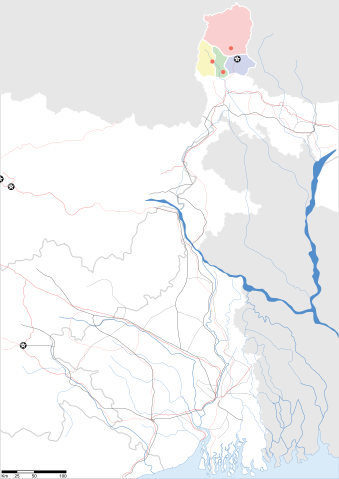
Sikkim locator map |
||
| Description |
Map of w:Sikkim with road and rail lines. Equirectangular projection. Geographic limits of the map: top=28.15, bottom=21.48, left=84.99, right=90.15. |
||
| তাৰিখ | |||
| উৎস |
নিজা কাৰ্য |
||
| স্ৰষ্টা |
|
||
| অনুমতি (এই ফাইলৰ পুনঃব্যৱহাৰ) |
মই, এই কামৰ স্বত্বাধিকাৰী, ইয়াৰ দ্বাৰা মই এই কামক তলত বৰ্ননা দিয়া অনুজ্ঞাপত্ৰৰ অধীনত প্ৰকাশ কৰিলো: এই ফাইলটো ক্ৰিয়েটিভ কমন্স এট্ৰিবইউচন-চেয়াৰ এলাইক ৩.০ আন্প'ৰ্টেড অনুজ্ঞাপত্ৰৰ অধীনত।
|
||
| Geotemporal data | |||
| Date depicted | second half of 20 century আৰু 21 century | ||
| Georeferencing | If inappropriate please set warp_status = skip to hide. | ||
| Archival data | |||
| টোকা | Part of WikiProject India Maps | ||
ফাইলৰ ইতিবৃত্ত
ফাইলৰ আগৰ অৱস্থা চাবলৈ সেই তাৰিখ/সময়ত ক্লিক কৰক।
| তাৰিখ/সময় | ক্ষুদ্ৰ প্ৰতিকৃতি | আকাৰ | সদস্য | মন্তব্য | |
|---|---|---|---|---|---|
| বৰ্তমান | 09:58, 12 May 2007 | | 1,595 × 2,256 (244 KB) | Planemad | border fix |
| 19:20, 7 May 2007 |  | 1,595 × 2,256 (252 KB) | Planemad | border | |
| 19:14, 7 May 2007 |  | 1,595 × 2,256 (245 KB) | Planemad | {{WikiProject_India_Maps |Title=Gujarat locator map.svg locator map |Description=Map of w:Gujarat locator map.svg with road and rail lines. |Source= |Date=May 2007 |Author=w:user:Planemad }} Category:WikiProject India State Maps |
ফাইল ব্যৱহাৰ
তলত দিয়া পৃষ্ঠাটোৱে এই ফাইলটো ব্যৱহাৰ কৰে:
ফাইলৰ গোলকীয় ব্যৱহাৰ
তলত দিয়া আন ৱিকিসমূহে এই ফাইলটো ব্যৱহাৰ কৰে:
- be.wikipedia.org-ৰ ব্যৱহাৰ
- de.wikipedia.org-ৰ ব্যৱহাৰ
- dty.wikipedia.org-ৰ ব্যৱহাৰ
- en.wikipedia.org-ৰ ব্যৱহাৰ
- es.wikipedia.org-ৰ ব্যৱহাৰ
- fa.wikipedia.org-ৰ ব্যৱহাৰ
- gu.wikipedia.org-ৰ ব্যৱহাৰ
- hi.wikipedia.org-ৰ ব্যৱহাৰ
- lv.wikipedia.org-ৰ ব্যৱহাৰ
- mai.wikipedia.org-ৰ ব্যৱহাৰ
- ml.wikipedia.org-ৰ ব্যৱহাৰ
- ms.wikipedia.org-ৰ ব্যৱহাৰ
- or.wikipedia.org-ৰ ব্যৱহাৰ
- pam.wikipedia.org-ৰ ব্যৱহাৰ
- pnb.wikipedia.org-ৰ ব্যৱহাৰ
- sw.wikipedia.org-ৰ ব্যৱহাৰ
- ta.wikipedia.org-ৰ ব্যৱহাৰ
- uk.wikipedia.org-ৰ ব্যৱহাৰ
- vi.wikipedia.org-ৰ ব্যৱহাৰ
- yo.wikipedia.org-ৰ ব্যৱহাৰ