
চিত্ৰ:Austria adm location map.svg

মূল ফাইল (SVG ফাইল, সাধাৰণতঃ 1,256 × 700 পিক্সেল, ফাইল মাত্ৰা: 183 KB)
| এই ফাইলটো ৱিকিমিডিয়া কমন্সৰ পৰা আমদানি কৰা হৈছে। ফাইল বিৱৰণ পৃষ্ঠাৰ সবিশেষ তথ্য তলত উল্লেখ কৰা হ’ল ।
|
সাৰাংশ
| বিৱৰণ |
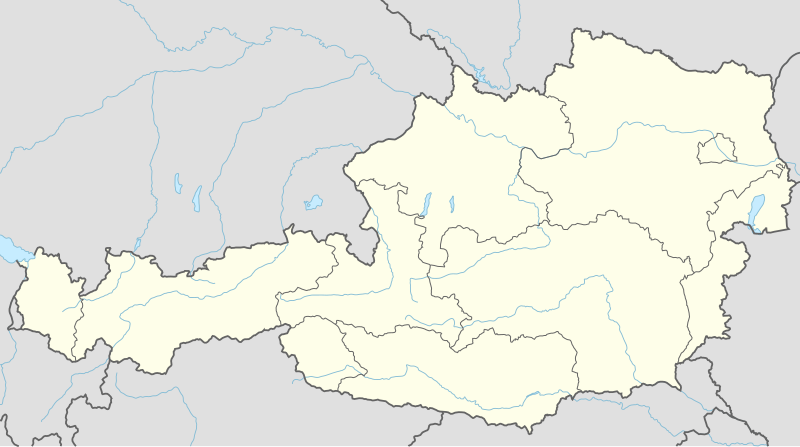
Deutsch: Positionskarte von Österreich
English: Location map of Austria
|
||||||||||||
| তাৰিখ | |||||||||||||
| উৎস |
Own work using:
|
||||||||||||
| লেখক | NordNordWest | ||||||||||||
| SVG genesis |
|
||||||||||||

অনুজ্ঞাপত্ৰ
Usage of this file with:

explanatory notes: Legally binding is only the full legalcode. For a free usage I recommend to respect the following licence conditions:
1. Provide my name as given above: NordNordWest,
2. a copy of, or the URI for, the applicable license: https://creativecommons.org/licenses/by-sa/3.0/de/legalcode,
3. the title of the work,
4. in the case of an adaptation, a credit identifying the use of the work in the adaptation.
This license and the rights granted hereunder will terminate automatically upon any breach by you of the terms of this license. Any of the above conditions can be waived if you get permission from the copyright holder. If you have questions or wish differing conditions, please contact me through nnwest or my discussion page ![]() t-online.de
t-online.de
- আপুনি স্বাধীনভাৱে:
- বিতৰণ কৰিব পাৰে – কামটো নকল (কপি), বিতৰণ আৰু প্ৰেৰণ কৰিবলৈ
- পুনৰ্মিশ্ৰণ কৰিবলৈ – কামটো অভিযোজন কৰিবলৈ
- তলত উল্লেখ কৰা চৰ্ত্তসমূহৰ ভিত্তিত:
- স্বীকৃতিপ্ৰদান – আপুনি প্ৰয়োজনীয় স্বীকৃতি দিয়াৰ লগতে অনুজ্ঞাপত্ৰলৈ লিংক আৰু কোনো সালসলনিৰ ইংগিত দিব লাগিব। আপুনি এয়া উপযুক্ত ধৰণেৰে দিব পাৰে, মাত্ৰ অনুজ্ঞাপত্ৰধাৰীয়ে আপোনাক বা আপোনাৰ কামক মঞ্জুৰী জনোৱাৰ দৰে নিলিখিব।
- একে ধৰণে চেয়াৰ কৰক – যদি আপুনি এই কামটো পৰিবৰ্তন, ৰূপান্তৰ বা এই কামটোৰ উপৰত ভিত্তি কৰি নতুন সৃষ্টিকৰ্ম তৈয়াৰ কৰে, আপুনি শেষৰ কৰ্মটো পূৰ্বৰ কৰ্মটোৰ সৈতে একে বা একেধৰণৰ অনুজ্ঞাপত্ৰৰ আওতাত বিতৰণ কৰিব পাৰে।

ফাইলৰ ইতিবৃত্ত
ফাইলৰ আগৰ অৱস্থা চাবলৈ সেই তাৰিখ/সময়ত ক্লিক কৰক।
| তাৰিখ/সময় | ক্ষুদ্ৰ প্ৰতিকৃতি | আকাৰ | সদস্য | মন্তব্য | |
|---|---|---|---|---|---|
| বৰ্তমান | 19:02, 2 December 2014 | | 1,256 × 700 (183 KB) | NordNordWest | == {{int:filedesc}} == {{Information |Description= {{de|1=Positionskarte von Österreich}} {{en|1=Location map of Austria}} {{Location map series N |stretching=150 |top=49.2 |bottom=46.3 |left=9.4 |right=17.2 }} |Source={{Own using}} * United States Na... |
ফাইল ব্যৱহাৰ
তলত দিয়া 2 পৃষ্ঠাবোৰে এই ফাইলটো ব্যৱহাৰ কৰে:
ফাইলৰ গোলকীয় ব্যৱহাৰ
তলত দিয়া আন ৱিকিসমূহে এই ফাইলটো ব্যৱহাৰ কৰে:
- ab.wikipedia.org-ৰ ব্যৱহাৰ
- ast.wikipedia.org-ৰ ব্যৱহাৰ
- Amstetten
- Viena
- Minihof-Liebau
- Burgruine Starhemberg
- Burgruine Aggstein
- Castiellu d'Ambras
- Donnerskirchen
- Selva de Bohemia
- Salzburgu
- Fugging
- Graz
- Innsbruck
- Linz
- Patrimoniu de la Humanidá n'Austria
- Palaciu Belvedere
- Estadiu Ernst Happel
- Universidá de Viena
- Universidá d'Economía de Viena
- Circuitu d'Österreichring
- Eisenstadt
- Klagenfurt
- Sankt Pölten
- Bregenz
- Módulu:Mapa de llocalización/datos/Austria
- Leibnitz
- Módulu:Mapa de llocalización/datos/Austria/usu
- Fraxern
- Bañu central de Viena
- Berg und Löwenherz
- Aeropuertu de Graz
- Aeropuertu d'Innsbruck
- Aeropuertu de Klagenfurt
- Aeropuertu de Linz
- Catedral de San Esteban de Viena
- Ferrocarril de Mariazell
- azb.wikipedia.org-ৰ ব্যৱহাৰ
- ban.wikipedia.org-ৰ ব্যৱহাৰ
- bh.wikipedia.org-ৰ ব্যৱহাৰ
- bn.wikipedia.org-ৰ ব্যৱহাৰ
এই ফাইলটোৰ অধিক গোলকীয় ব্যৱহাৰ চাওক।