
চিত্ৰ:Jackson Glacier terminus.jpg
এই খচৰাৰ আকাৰ: 800 × 540 পিক্সেল. আন ৰিজ'লিউশ্যনসমূহ: 320 × 216 পিক্সেল | 640 × 432 পিক্সেল | 900 × 608 পিক্সেল।
মূল ফাইল (900 × 608 পিক্সেল, ফাইলৰ মাত্ৰা: 131 KB, MIME প্ৰকাৰ: image/jpeg)
| এই ফাইলটো ৱিকিমিডিয়া কমন্সৰ পৰা আমদানি কৰা হৈছে। ফাইল বিৱৰণ পৃষ্ঠাৰ সবিশেষ তথ্য তলত উল্লেখ কৰা হ’ল ।
|
সাৰাংশ
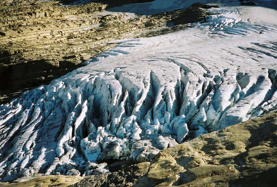
| বিৱৰণ | Image of the terminal end of Jackson Glacier in Glacier National Park (U.S.) |
| উৎস | United States Geological Survey...from the following link [1], enlarged at [2] |
| লেখক | USGS |
![[2]](https://www.nrmsc.usgs.gov/images/gcc/Jackson_terminus.jpg)
| Camera location | | View this and other nearby images on: OpenStreetMap |
|---|
অনুজ্ঞাপত্ৰ
This image is in the public domain in the United States because it only contains materials that originally came from the United States Geological Survey, an agency of the United States Department of the Interior. For more information, see the official USGS copyright policy.
|
ফাইলৰ ইতিবৃত্ত
ফাইলৰ আগৰ অৱস্থা চাবলৈ সেই তাৰিখ/সময়ত ক্লিক কৰক।
| তাৰিখ/সময় | ক্ষুদ্ৰ প্ৰতিকৃতি | আকাৰ | সদস্য | মন্তব্য | |
|---|---|---|---|---|---|
| বৰ্তমান | 00:16, 20 January 2008 | | 900 × 608 (131 KB) | MONGO | {{Information |Description=Image of the terminal end of Jackson Glacier in Glacier National Park (U.S.) |Source=United States Geological Survey...from the following link [http://www.nrmsc.usgs.g |
ফাইল ব্যৱহাৰ
তলত দিয়া পৃষ্ঠাটোৱে এই ফাইলটো ব্যৱহাৰ কৰে:
ফাইলৰ গোলকীয় ব্যৱহাৰ
তলত দিয়া আন ৱিকিসমূহে এই ফাইলটো ব্যৱহাৰ কৰে:
- ceb.wikipedia.org-ৰ ব্যৱহাৰ
- cy.wikipedia.org-ৰ ব্যৱহাৰ
- el.wikipedia.org-ৰ ব্যৱহাৰ
- en.wikipedia.org-ৰ ব্যৱহাৰ
- en.wikiversity.org-ৰ ব্যৱহাৰ
- eo.wikipedia.org-ৰ ব্যৱহাৰ
- fa.wikipedia.org-ৰ ব্যৱহাৰ
- fr.wikipedia.org-ৰ ব্যৱহাৰ
- fy.wikipedia.org-ৰ ব্যৱহাৰ
- hr.wikipedia.org-ৰ ব্যৱহাৰ
- hy.wikipedia.org-ৰ ব্যৱহাৰ
- ku.wikipedia.org-ৰ ব্যৱহাৰ
- nl.wikipedia.org-ৰ ব্যৱহাৰ
- sr.wikipedia.org-ৰ ব্যৱহাৰ
- ur.wikipedia.org-ৰ ব্যৱহাৰ
- www.wikidata.org-ৰ ব্যৱহাৰ