
চিত্ৰ:Orissa State map.svg

Size of this PNG preview of this SVG file: 740 × 599 পিক্সেল. আন ৰিজ'লিউশ্যনসমূহ: 296 × 240 পিক্সেল | 593 × 480 পিক্সেল | 948 × 768 পিক্সেল | 1,264 × 1,024 পিক্সেল | 2,529 × 2,048 পিক্সেল | 2,184 × 1,769 পিক্সেল।
মূল ফাইল (SVG ফাইল, সাধাৰণতঃ 2,184 × 1,769 পিক্সেল, ফাইল মাত্ৰা: 1.77 MB)
| এই ফাইলটো ৱিকিমিডিয়া কমন্সৰ পৰা আমদানি কৰা হৈছে। ফাইল বিৱৰণ পৃষ্ঠাৰ সবিশেষ তথ্য তলত উল্লেখ কৰা হ’ল ।
|
সাৰাংশ
| শিৰোনাম |
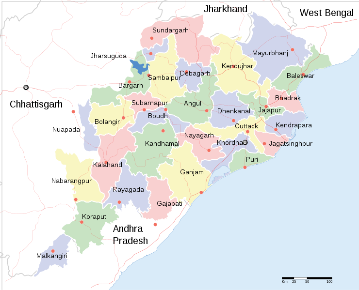
English: Locator map of Indian state, Odisha. |
| Description |
Locator map of the state of Orissa, India with district boundaries. |
| তাৰিখ | |
| উৎস |
নিজা কাৰ্য |
| স্ৰষ্টা | |
| অনুমতি (এই ফাইলৰ পুনঃব্যৱহাৰ) |
মই, এই কামৰ স্বত্বাধিকাৰী, ইয়াৰ দ্বাৰা মই এই কামক তলত বৰ্ননা দিয়া অনুজ্ঞাপত্ৰৰ অধীনত প্ৰকাশ কৰিলো: এই ফাইলটো ক্ৰিয়েটিভ কমন্স এট্ৰিবইউচন-চেয়াৰ এলাইক ৩.০ আন্প'ৰ্টেড অনুজ্ঞাপত্ৰৰ অধীনত।
|
| Geotemporal data | |
| Date depicted | second half of 20 century আৰু 21 century |
| Georeferencing | If inappropriate please set warp_status = skip to hide. |
| Archival data | |
| টোকা | Part of WikiProject India Maps |
| অন্যান্য সংস্কৰণ |
[]
|


ফাইলৰ ইতিবৃত্ত
ফাইলৰ আগৰ অৱস্থা চাবলৈ সেই তাৰিখ/সময়ত ক্লিক কৰক।
| তাৰিখ/সময় | ক্ষুদ্ৰ প্ৰতিকৃতি | আকাৰ | সদস্য | মন্তব্য | |
|---|---|---|---|---|---|
| বৰ্তমান | 20:18, 10 June 2020 | | 2,184 × 1,769 (1.77 MB) | শরদিন্দু ভট্টাচার্য্য | File uploaded using svgtranslate tool (https://svgtranslate.toolforge.org/). Added translation for bn. |
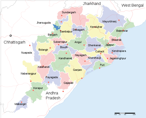
| 09:35, 1 April 2011 |  | 2,184 × 1,769 (1.76 MB) | Jayantanth | == {{int:filedesc}} == {{WikiProject_India_Maps |Title=Orissa locator map |Description=Locator map of the state of Orissa, India with district boundaries. |Source= |Date=2008-12-29 |Author={{User:PlaneMad/Info}} }} [[Category:WikiPr |
ফাইল ব্যৱহাৰ
এই ফাইলটো কোনো পৃষ্ঠাই ব্যৱহাৰ কৰা নাই
ফাইলৰ গোলকীয় ব্যৱহাৰ
তলত দিয়া আন ৱিকিসমূহে এই ফাইলটো ব্যৱহাৰ কৰে:
- bcl.wikipedia.org-ৰ ব্যৱহাৰ
- bn.wikipedia.org-ৰ ব্যৱহাৰ
- cv.wikipedia.org-ৰ ব্যৱহাৰ
- en.wikipedia.org-ৰ ব্যৱহাৰ
- fa.wikipedia.org-ৰ ব্যৱহাৰ
- fr.wikipedia.org-ৰ ব্যৱহাৰ
- ha.wikipedia.org-ৰ ব্যৱহাৰ
- hr.wikipedia.org-ৰ ব্যৱহাৰ
- hy.wikipedia.org-ৰ ব্যৱহাৰ
- it.wikipedia.org-ৰ ব্যৱহাৰ
- mai.wikipedia.org-ৰ ব্যৱহাৰ
- ml.wikipedia.org-ৰ ব্যৱহাৰ
- mn.wikipedia.org-ৰ ব্যৱহাৰ
- ne.wikipedia.org-ৰ ব্যৱহাৰ
- pa.wikipedia.org-ৰ ব্যৱহাৰ
- ru.wikipedia.org-ৰ ব্যৱহাৰ
- sa.wikipedia.org-ৰ ব্যৱহাৰ
- sd.wikipedia.org-ৰ ব্যৱহাৰ
- tg.wikipedia.org-ৰ ব্যৱহাৰ
- ur.wikipedia.org-ৰ ব্যৱহাৰ
- zh.wikipedia.org-ৰ ব্যৱহাৰ
এই ফাইলটোৰ অধিক গোলকীয় ব্যৱহাৰ চাওক।