
চিত্ৰ:BC-relief.png

এই খচৰাৰ আকাৰ: 585 × 599 পিক্সেল. আন ৰিজ'লিউশ্যনসমূহ: 234 × 240 পিক্সেল | 469 × 480 পিক্সেল | 659 × 675 পিক্সেল।
মূল ফাইল (659 × 675 পিক্সেল, ফাইলৰ মাত্ৰা: 605 KB, MIME প্ৰকাৰ: image/png)
| এই ফাইলটো ৱিকিমিডিয়া কমন্সৰ পৰা আমদানি কৰা হৈছে। ফাইল বিৱৰণ পৃষ্ঠাৰ সবিশেষ তথ্য তলত উল্লেখ কৰা হ’ল ।
|
সাৰাংশ
| বিৱৰণ |
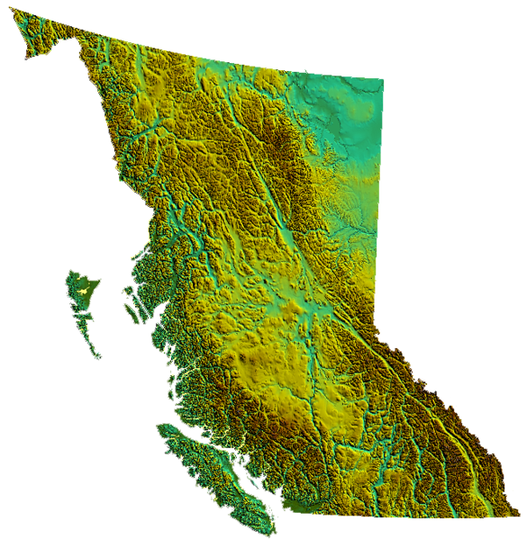
relief of British Columbia, Canada produced from USGS data |
| তাৰিখ | ৩১ মাৰ্চ ২০০৬ (original upload date) |
| উৎস | No machine-readable source provided. Own work assumed (based on copyright claims). |
| লেখক | No machine-readable author provided. Qyd assumed (based on copyright claims). |
অনুজ্ঞাপত্ৰ
| মই, এই কামৰ স্বত্বাধিকাৰী, এই কামক ৰাজহুৱা ডমেইনত উন্মোচন কৰিছো। ই বিশ্বব্যাপী প্ৰযোজ্য হ’ব। কিছুমান দেশত এইটো আইনগতভাৱে নহবও পাৰে, যদি সেয়ে হয়: মই যিকোনো ব্যক্তিক যিকোনো কাৰণৰ বাবে এই কাম ব্যৱহাৰ কৰাৰ অধিকাৰ প্ৰদান কৰিছো, কোনো চুক্তি নহোৱাকৈ, যেতিয়ালৈকে এই চুক্তিসমূহ আইন দ্বাৰা প্ৰয়োজনীয় নহয়। |
ফাইলৰ ইতিবৃত্ত
ফাইলৰ আগৰ অৱস্থা চাবলৈ সেই তাৰিখ/সময়ত ক্লিক কৰক।
| তাৰিখ/সময় | ক্ষুদ্ৰ প্ৰতিকৃতি | আকাৰ | সদস্য | মন্তব্য | |
|---|---|---|---|---|---|
| বৰ্তমান | 01:39, 4 November 2006 | | 659 × 675 (605 KB) | Qyd | transparent background |
| 02:01, 31 March 2006 |  | 659 × 675 (536 KB) | Qyd | relief of British Columbia, Canada |
ফাইল ব্যৱহাৰ
তলত দিয়া পৃষ্ঠাটোৱে এই ফাইলটো ব্যৱহাৰ কৰে:
ফাইলৰ গোলকীয় ব্যৱহাৰ
তলত দিয়া আন ৱিকিসমূহে এই ফাইলটো ব্যৱহাৰ কৰে:
- bcl.wikipedia.org-ৰ ব্যৱহাৰ
- de.wikipedia.org-ৰ ব্যৱহাৰ
- en.wikipedia.org-ৰ ব্যৱহাৰ
- Coombs, British Columbia
- Della Falls
- Regional District of Kootenay Boundary
- Eagle Pass (British Columbia)
- Cameron Bar Indian Reserve No. 13
- Mount McGuire (Alberta)
- Mount King Edward
- Flores Island (British Columbia)
- Ball Range
- 105 Mile Post Indian Reserve No. 2
- Madeira Park
- Queen Charlotte Sound (Canada)
- Nootka Island
- Beatrice Peak
- Isabelle Peak
- Duke Point, British Columbia
- Haiduk Peak
- Kinney Lake
- Spanish Bonk
- Mount Cornwell (Canada)
- Laidlaw, British Columbia
- Pearse Island
- Portland Canal
- President Range
- Regional District of Central Kootenay
- Regional District of Bulkley-Nechako
- Cowichan Valley
- Saltair, British Columbia
- Mount Macdonald
- Basque, British Columbia
- Oweekeno
- Clark Range (Canada)
- Kaien Island
- Mount Field (British Columbia)
- Beaverfoot Range
- Halfmoon Bay, British Columbia
- Atlin Lake
- Williston Lake
- Columbia Valley
- Lake Revelstoke
- Moyie Lake
- Wood Lake (British Columbia)
- Baynes Sound
- Kokanee Lake
- Kinbasket Lake
- Wasa Lake
- Wilmer, British Columbia
- Inga Lake
এই ফাইলটোৰ অধিক গোলকীয় ব্যৱহাৰ চাওক।