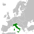
চিত্ৰ:Kingdom of Italy (1936).svg
এই পৃষ্ঠাৰ সমল অন্য ভাষাত সমৰ্থিত নহয়।
অৱয়ব
অসমীয়া ৱিকিপিডিয়াৰ পৰা

Size of this PNG preview of this SVG file: 450 × 456 পিক্সেল. আন ৰিজ'লিউশ্যনসমূহ: 237 × 240 পিক্সেল | 474 × 480 পিক্সেল | 758 × 768 পিক্সেল | 1,011 × 1,024 পিক্সেল | 2,021 × 2,048 পিক্সেল।
মূল ফাইল (SVG ফাইল, সাধাৰণতঃ 450 × 456 পিক্সেল, ফাইল মাত্ৰা: 462 KB)
| এই ফাইলটো ৱিকিমিডিয়া কমন্সৰ পৰা আমদানি কৰা হৈছে। ফাইল বিৱৰণ পৃষ্ঠাৰ সবিশেষ তথ্য তলত উল্লেখ কৰা হ’ল ।
|
সাৰাংশ
কেপ্চন
এই ফাইলে কি প্ৰতিনিধিত্ব কৰে তাৰ এটা শাৰীত ব্যাখ্যা কৰক
Items portrayed in this file
depicts ইংৰাজী
ৱিকিতথ্য আইটেম অবিহনে যিকোনো মান
copyright status ইংৰাজী
copyrighted ইংৰাজী
inception ইংৰাজী
২৪ মে' 2013
source of file ইংৰাজী
ফাইলৰ ইতিবৃত্ত
ফাইলৰ আগৰ অৱস্থা চাবলৈ সেই তাৰিখ/সময়ত ক্লিক কৰক।
| তাৰিখ/সময় | ক্ষুদ্ৰ প্ৰতিকৃতি | আকাৰ | সদস্য | মন্তব্য | |
|---|---|---|---|---|---|
| বৰ্তমান | 07:53, 12 August 2013 |  | 450 × 456 (462 KB) | Alphathon | Fixed Dutch polders (see main file) |
| 07:52, 12 August 2013 |  | 450 × 456 (463 KB) | Alphathon | Fixed Yugoslav-Hungarian border (see main file) | |
| 20:32, 24 May 2013 |  | 450 × 456 (461 KB) | TRAJAN 117 | {{Information |Description ={{en|1=The Kingdom of Italy in 1936.}} |Source ={{own}} {{AttribSVG|Blank map of Europe 1929-1938.svg|Alphathon}} |Author =TRAJAN 117 {{created with Inkscape}} |Date =2013-05-... |
ফাইল ব্যৱহাৰ
এই ফাইলটো কোনো পৃষ্ঠাই ব্যৱহাৰ কৰা নাই
ফাইলৰ গোলকীয় ব্যৱহাৰ
তলত দিয়া আন ৱিকিসমূহে এই ফাইলটো ব্যৱহাৰ কৰে:
- am.wikipedia.org-ৰ ব্যৱহাৰ
- bg.wikipedia.org-ৰ ব্যৱহাৰ
- cs.wikipedia.org-ৰ ব্যৱহাৰ
- de.wikipedia.org-ৰ ব্যৱহাৰ
- en.wikipedia.org-ৰ ব্যৱহাৰ
- es.wikipedia.org-ৰ ব্যৱহাৰ
- fi.wikipedia.org-ৰ ব্যৱহাৰ
- hr.wikipedia.org-ৰ ব্যৱহাৰ
- hu.wikipedia.org-ৰ ব্যৱহাৰ
- hy.wikipedia.org-ৰ ব্যৱহাৰ
- is.wikipedia.org-ৰ ব্যৱহাৰ
- it.wikipedia.org-ৰ ব্যৱহাৰ
- ko.wikipedia.org-ৰ ব্যৱহাৰ
- lij.wikipedia.org-ৰ ব্যৱহাৰ
- lld.wikipedia.org-ৰ ব্যৱহাৰ
- mk.wikipedia.org-ৰ ব্যৱহাৰ
- nl.wikipedia.org-ৰ ব্যৱহাৰ
- pl.wikipedia.org-ৰ ব্যৱহাৰ
- pt.wikipedia.org-ৰ ব্যৱহাৰ
- rue.wikipedia.org-ৰ ব্যৱহাৰ
- ru.wikipedia.org-ৰ ব্যৱহাৰ
- sq.wikipedia.org-ৰ ব্যৱহাৰ
- th.wikipedia.org-ৰ ব্যৱহাৰ
- tl.wikipedia.org-ৰ ব্যৱহাৰ
- tr.wikipedia.org-ৰ ব্যৱহাৰ
- uk.wikipedia.org-ৰ ব্যৱহাৰ
- uz.wikipedia.org-ৰ ব্যৱহাৰ
- vi.wikipedia.org-ৰ ব্যৱহাৰ
- xmf.wikipedia.org-ৰ ব্যৱহাৰ
মেটাডেটা
এই ফাইলত অতিৰিক্ত খবৰ আছে, হয়তো ডিজিটেল কেমেৰা বা স্কেনাৰ ব্যৱহাৰ কৰি সৃষ্টি বা পৰিৱৰ্তন কৰা হৈছে ।
এই ফাইলটো আচলৰ পৰা পৰিৱৰ্তন কৰা হৈছে, সেয়েহে পৰিৱৰ্তিত ফাইলটোৰ সৈতে নিমিলিব পাৰে ।
| চমু শীৰ্ষক | Countries of Europe |
|---|---|
| চিত্ৰ শিৰোনামা | A blank Map of Europe. Every country has an id which is its ISO-3166-1-ALPHA2 code in lower case.
Members of the EU have a class="eu", countries in europe (which I found turkey to be but russia not) have a class="europe".
Certain countries are further subdivided the United Kingdom has gb-gbn for Great Britain and gb-nir for Northern Ireland. Russia is divided into ru-kgd for the Kaliningrad Oblast and ru-main for the Main body of Russia. There is the additional grouping #xb for the "British Islands" (the UK with its Crown Dependencies - Jersey, Guernsey and the Isle of Man)

Contributors.
Original Image: (http://commons.wikimedia.org/wiki/Image:Europe_countries.svg) Júlio Reis (http://commons.wikimedia.org/wiki/User:Tintazul).
Recolouring and tagging with country codes: Marian "maix" Sigler (http://commons.wikimedia.org/wiki/User:Maix)
Improved geographical features: http://commons.wikimedia.org/wiki/User:W!B:
Updated to reflect dissolution of Serbia & Montenegro: http://commons.wikimedia.org/wiki/User:Zirland
Updated to include British Crown Dependencies as seperate entities and regroup them as "British Islands", with some simplifications to the XML and CSS: James Hardy (http://commons.wikimedia.org/wiki/User:MrWeeble)
Released under CreativeCommons Attribution ShareAlike (http://creativecommons.org/licenses/by-sa/2.5/). |
| প্ৰস্থ | 450 |
| উচ্চতা | 456 |
"https://as.wikipedia.org/wiki/চিত্ৰ:Kingdom_of_Italy_(1936).svg"ৰ পৰা অনা হৈছে


