
চিত্ৰ:Kamarupa 7th-8th Century AD.jpg
এই খচৰাৰ আকাৰ: 800 × 600 পিক্সেল. আন ৰিজ'লিউশ্যনসমূহ: 320 × 240 পিক্সেল | 640 × 480 পিক্সেল | 960 × 720 পিক্সেল।
মূল ফাইল (960 × 720 পিক্সেল, ফাইলৰ মাত্ৰা: 485 KB, MIME প্ৰকাৰ: image/jpeg)
| এই ফাইলটো ৱিকিমিডিয়া কমন্সৰ পৰা আমদানি কৰা হৈছে। ফাইল বিৱৰণ পৃষ্ঠাৰ সবিশেষ তথ্য তলত উল্লেখ কৰা হ’ল ।
|

সাৰাংশ
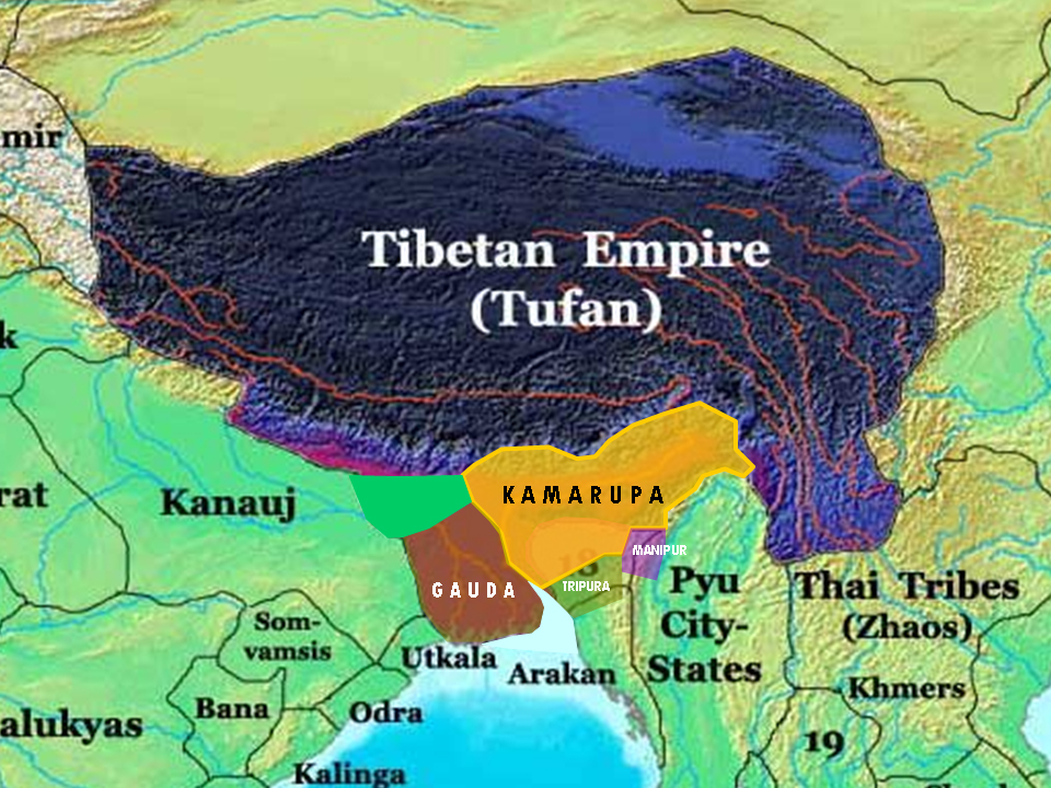
| বিৱৰণ | This is the 7th and 8th century extent of Kamarupa kingdom in Assam. The map is created using historical data from reliable books and on the basis of archaeological findings in this region. |
| উৎস | নিজা কাৰ্য |
| লেখক | Porikolpok Oxom |
অনুজ্ঞাপত্ৰ
মই, এই কামৰ স্বত্বাধিকাৰী, ইয়াৰ দ্বাৰা মই এই কামক তলত বৰ্ননা দিয়া অনুজ্ঞাপত্ৰৰ অধীনত প্ৰকাশ কৰিলো:
এই ফাইলটো ক্ৰিয়েটিভ কমন্স এট্ৰিবইউচন-চেয়াৰ এলাইক ৩.০ আন্প'ৰ্টেড অনুজ্ঞাপত্ৰৰ অধীনত।
- আপুনি স্বাধীনভাৱে:
- বিতৰণ কৰিব পাৰে – কামটো নকল (কপি), বিতৰণ আৰু প্ৰেৰণ কৰিবলৈ
- পুনৰ্মিশ্ৰণ কৰিবলৈ – কামটো অভিযোজন কৰিবলৈ
- তলত উল্লেখ কৰা চৰ্ত্তসমূহৰ ভিত্তিত:
- স্বীকৃতিপ্ৰদান – আপুনি প্ৰয়োজনীয় স্বীকৃতি দিয়াৰ লগতে অনুজ্ঞাপত্ৰলৈ লিংক আৰু কোনো সালসলনিৰ ইংগিত দিব লাগিব। আপুনি এয়া উপযুক্ত ধৰণেৰে দিব পাৰে, মাত্ৰ অনুজ্ঞাপত্ৰধাৰীয়ে আপোনাক বা আপোনাৰ কামক মঞ্জুৰী জনোৱাৰ দৰে নিলিখিব।
- একে ধৰণে চেয়াৰ কৰক – যদি আপুনি এই কামটো পৰিবৰ্তন, ৰূপান্তৰ বা এই কামটোৰ উপৰত ভিত্তি কৰি নতুন সৃষ্টিকৰ্ম তৈয়াৰ কৰে, আপুনি শেষৰ কৰ্মটো পূৰ্বৰ কৰ্মটোৰ সৈতে একে বা একেধৰণৰ অনুজ্ঞাপত্ৰৰ আওতাত বিতৰণ কৰিব পাৰে।
ফাইলৰ ইতিবৃত্ত
ফাইলৰ আগৰ অৱস্থা চাবলৈ সেই তাৰিখ/সময়ত ক্লিক কৰক।
| তাৰিখ/সময় | ক্ষুদ্ৰ প্ৰতিকৃতি | আকাৰ | সদস্য | মন্তব্য | |
|---|---|---|---|---|---|
| বৰ্তমান | 12:32, 16 March 2008 | | 960 × 720 (485 KB) | Porikolpok Oxom~commonswiki | This is the 7th and 8th century extent of Kamarupa kingdom in Assam. The map is created using historical data from reliable books and on the basis of archaeological findings in this region. Revised with mouth of brahmaputra and ganges. |
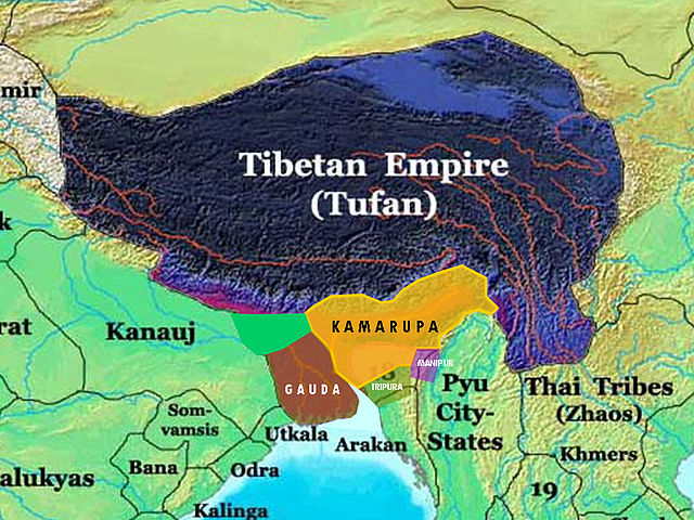
| 11:35, 14 March 2008 |  | 960 × 720 (492 KB) | Porikolpok Oxom~commonswiki | {{Information |Description= This is the 7th and 8th century extent of Kamarupa kingdom in Assam. The map is created using historical data from reliable books and on the basis of archaeological findings in this region. |Source=self-made |Date= |Author= |
ফাইল ব্যৱহাৰ
এই ফাইলটো কোনো পৃষ্ঠাই ব্যৱহাৰ কৰা নাই
ফাইলৰ গোলকীয় ব্যৱহাৰ
তলত দিয়া আন ৱিকিসমূহে এই ফাইলটো ব্যৱহাৰ কৰে: