
চিত্ৰ:Tripura map.png
এই খচৰাৰ আকাৰ: 413 × 599 পিক্সেল. আন ৰিজ'লিউশ্যনসমূহ: 165 × 240 পিক্সেল | 331 × 480 পিক্সেল | 899 × 1,304 পিক্সেল।
মূল ফাইল (899 × 1,304 পিক্সেল, ফাইলৰ মাত্ৰা: 164 KB, MIME প্ৰকাৰ: image/png)
| এই ফাইলটো ৱিকিমিডিয়া কমন্সৰ পৰা আমদানি কৰা হৈছে। ফাইল বিৱৰণ পৃষ্ঠাৰ সবিশেষ তথ্য তলত উল্লেখ কৰা হ’ল ।
|

|
This locator map image could be re-created using vector graphics as an SVG file. This has several advantages; see Commons:Media for cleanup for more information. If an SVG form of this image is available, please upload it and afterwards replace this template with
{{vector version available|new image name}}.
It is recommended to name the SVG file “Tripura map.svg”—then the template Vector version available (or Vva) does not need the new image name parameter. |
সাৰাংশ
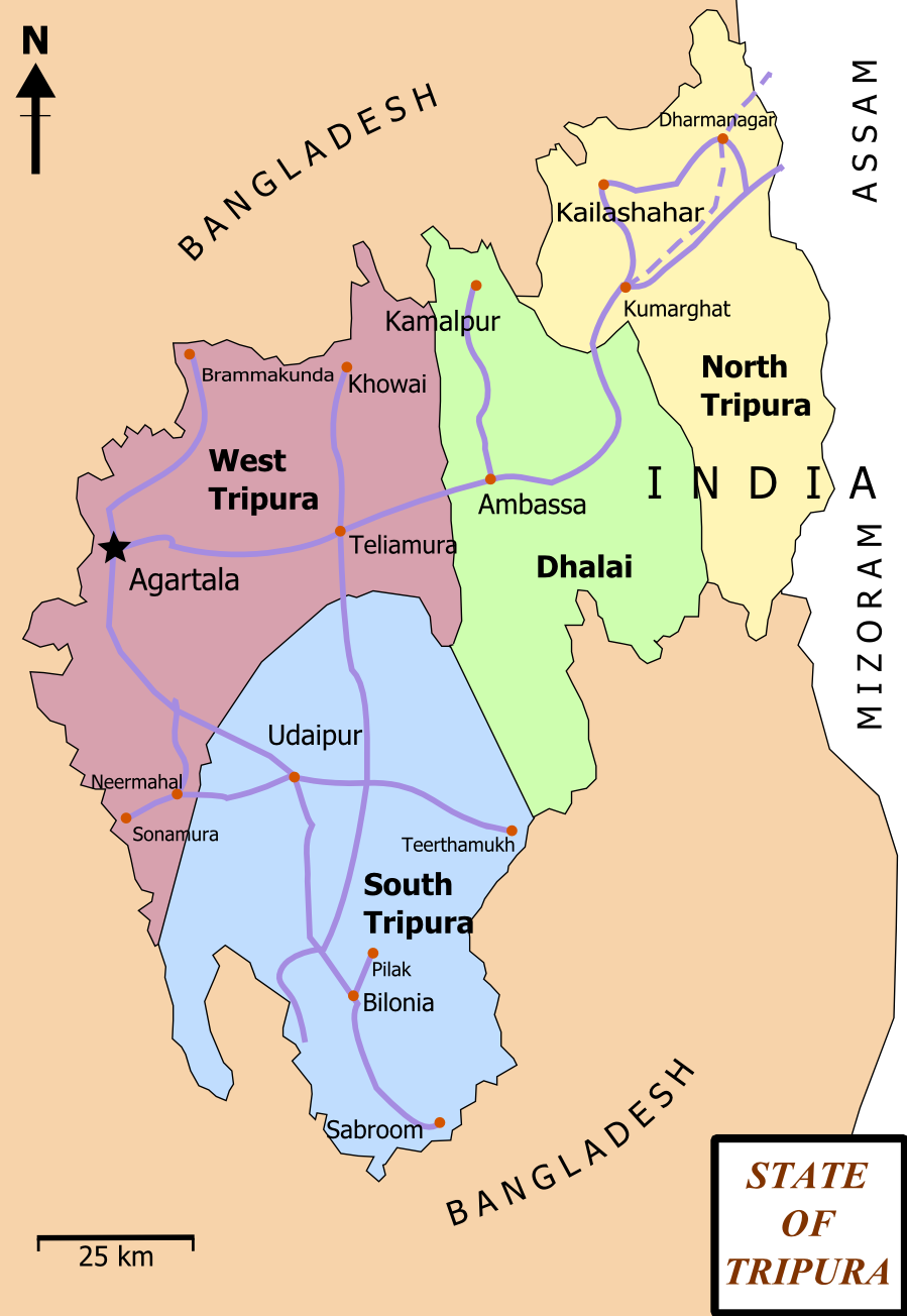
| বিৱৰণ | Map of State of Tripura. The map shows the former 4 districts of Tripura, with the state's roads and railway networks detailed. Railway was extended upto Agartala from Kumbarghat and opened by 2008.[1] |
| তাৰিখ | |
| উৎস | নিজা কাৰ্য |
| লেখক | Wikigringo |
| অনুমতি (এই ফাইলৰ পুনঃব্যৱহাৰ) |
attribution to author. |
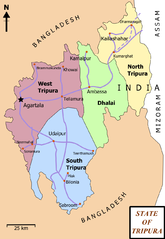
| অন্যান্য সংস্কৰণ | Tripura locator map blank.svg.png |
| শিৰোনাম |
Tripura locator map |
| Description |
Locator map of the state of Tripura, India with district boundaries. |
| তাৰিখ | |
| উৎস |
নিজা কাৰ্য |
| স্ৰষ্টা | |
| অনুমতি (এই ফাইলৰ পুনঃব্যৱহাৰ) |
মই, এই কামৰ স্বত্বাধিকাৰী, ইয়াৰ দ্বাৰা মই এই কামক তলত বৰ্ননা দিয়া অনুজ্ঞাপত্ৰৰ অধীনত প্ৰকাশ কৰিলো: এই ফাইলটো ক্ৰিয়েটিভ কমন্স এট্ৰিবইউচন-চেয়াৰ এলাইক ৩.০ আন্প'ৰ্টেড অনুজ্ঞাপত্ৰৰ অধীনত।
|
| Geotemporal data | |
| Date depicted | second half of 20 century আৰু 21 century |
| Georeferencing | If inappropriate please set warp_status = skip to hide. |
| Archival data | |
| টোকা | Part of WikiProject India Maps |
অনুজ্ঞাপত্ৰ
মই, এই কামৰ স্বত্বাধিকাৰী, ইয়াৰ দ্বাৰা মই এই কামক তলত বৰ্ননা দিয়া অনুজ্ঞাপত্ৰৰ অধীনত প্ৰকাশ কৰিলো:

|
GNU Free Documentation License ৰ চুক্তিসমূহৰ অন্তৰ্গত এই দস্তাবেজ কপি, বিতৰণ আৰু/অথবা সলনি কৰাৰ অনুমতি প্ৰদান কৰা হৈছে, সংস্কৰণ 1.2 অথবা Free Software Foundation দ্বাৰা প্ৰকাশ কৰা পিছৰ যিকোনো সংস্কৰণত; কোনো অপৰিবৰ্তনশীল অংশ, কোনো ফ্ৰন্ট-কভাৰ টেক্সট, আৰু কোনো বেক-কভাৰ টেক্সট নহোৱাকৈ। অনুজ্ঞাৰ এটা কপি GNU Free Documentation License নামৰ অংশত অন্তৰ্ভুক্ত কৰা হৈছে। |
This file is licensed under the Creative Commons Attribution-Share Alike 4.0 International, 3.0 Unported, 2.5 Generic, 2.0 Generic and 1.0 Generic license.
- আপুনি স্বাধীনভাৱে:
- বিতৰণ কৰিব পাৰে – কামটো নকল (কপি), বিতৰণ আৰু প্ৰেৰণ কৰিবলৈ
- পুনৰ্মিশ্ৰণ কৰিবলৈ – কামটো অভিযোজন কৰিবলৈ
- তলত উল্লেখ কৰা চৰ্ত্তসমূহৰ ভিত্তিত:
- স্বীকৃতিপ্ৰদান – আপুনি প্ৰয়োজনীয় স্বীকৃতি দিয়াৰ লগতে অনুজ্ঞাপত্ৰলৈ লিংক আৰু কোনো সালসলনিৰ ইংগিত দিব লাগিব। আপুনি এয়া উপযুক্ত ধৰণেৰে দিব পাৰে, মাত্ৰ অনুজ্ঞাপত্ৰধাৰীয়ে আপোনাক বা আপোনাৰ কামক মঞ্জুৰী জনোৱাৰ দৰে নিলিখিব।
- একে ধৰণে চেয়াৰ কৰক – যদি আপুনি এই কামটো পৰিবৰ্তন, ৰূপান্তৰ বা এই কামটোৰ উপৰত ভিত্তি কৰি নতুন সৃষ্টিকৰ্ম তৈয়াৰ কৰে, আপুনি শেষৰ কৰ্মটো পূৰ্বৰ কৰ্মটোৰ সৈতে একে বা একেধৰণৰ অনুজ্ঞাপত্ৰৰ আওতাত বিতৰণ কৰিব পাৰে।
আপুনি আপোনাৰ পছন্দ অনুসৰি অনুজ্ঞাপত্ৰৰ নিৰ্বাচন কৰিব পাৰে।
ফাইলৰ ইতিবৃত্ত
ফাইলৰ আগৰ অৱস্থা চাবলৈ সেই তাৰিখ/সময়ত ক্লিক কৰক।
| তাৰিখ/সময় | ক্ষুদ্ৰ প্ৰতিকৃতি | আকাৰ | সদস্য | মন্তব্য | |
|---|---|---|---|---|---|
| বৰ্তমান | 17:06, 15 February 2012 | | 899 × 1,304 (164 KB) | Ras67 | cropped and optimized |
| 13:15, 27 February 2008 |  | 921 × 1,326 (229 KB) | Wikigringo | {{Information |Description=Map of State of Tripura. Map shows the 4 districts of Tripura along with roadways and small railway network present in the state. |Source=self-made |Date=02/27/2008 |Author= Wikigringo |Permission=attribution |
ফাইল ব্যৱহাৰ
তলত দিয়া পৃষ্ঠাটোৱে এই ফাইলটো ব্যৱহাৰ কৰে:
ফাইলৰ গোলকীয় ব্যৱহাৰ
তলত দিয়া আন ৱিকিসমূহে এই ফাইলটো ব্যৱহাৰ কৰে:
- bn.wikipedia.org-ৰ ব্যৱহাৰ
- ধর্মনগর
- কমলপুর
- ত্রিপুরা বিধানসভা নির্বাচন, ২০১৩
- ত্রিপুরা বিধানসভা নির্বাচন, ২০০৮
- ত্রিপুরা বিধানসভা নির্বাচন, ২০০৩
- ত্রিপুরা বিধানসভা নির্বাচন, ১৯৭২
- ত্রিপুরা বিধানসভা নির্বাচন, ১৯৭৭
- ত্রিপুরা বিধানসভা নির্বাচন, ১৯৮৩
- ত্রিপুরা বিধানসভা নির্বাচন, ১৯৮৮
- ত্রিপুরা বিধানসভা নির্বাচন, ১৯৯৩
- ত্রিপুরা বিধানসভা নির্বাচন, ১৯৯৮
- ca.wikipedia.org-ৰ ব্যৱহাৰ
- en.wikipedia.org-ৰ ব্যৱহাৰ
- Portal:India/Selected picture candidates
- Belonia, India
- User:Gppande/Album
- Portal:India/Selected picture candidates/Tripura district map
- 2008 Tripura Legislative Assembly election
- 2013 Tripura Legislative Assembly election
- Wikipedia:Graphics Lab/Map workshop/Archive/Apr 2013
- Santirbazar
- 2003 Tripura Legislative Assembly election
- 1998 Tripura Legislative Assembly election
- 1993 Tripura Legislative Assembly election
- 1988 Tripura Legislative Assembly election
- 1983 Tripura Legislative Assembly election
- 1977 Tripura Legislative Assembly election
- 1972 Tripura Legislative Assembly election
- eu.wikipedia.org-ৰ ব্যৱহাৰ
- fa.wikipedia.org-ৰ ব্যৱহাৰ
- gom.wikipedia.org-ৰ ব্যৱহাৰ
- hi.wikipedia.org-ৰ ব্যৱহাৰ
- hr.wikipedia.org-ৰ ব্যৱহাৰ
- incubator.wikimedia.org-ৰ ব্যৱহাৰ
- kk.wikipedia.org-ৰ ব্যৱহাৰ
- ml.wikipedia.org-ৰ ব্যৱহাৰ
- ne.wikipedia.org-ৰ ব্যৱহাৰ
- new.wikipedia.org-ৰ ব্যৱহাৰ
- no.wikipedia.org-ৰ ব্যৱহাৰ
এই ফাইলটোৰ অধিক গোলকীয় ব্যৱহাৰ চাওক।