| Volga River (Example) |
|---|
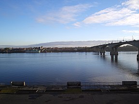
Volga in Yaroslavl (autumn morning) |
| উৎস |
Valdai Hills |
|---|
| মোহনা |
Caspian Sea |
|---|
| দেশৰ মাজেৰে প্ৰবাহমান |
Russia |
|---|
| অৱস্থান |
Astrakhan, Volgograd, Saratov, Samara, Kazan, Ulyanovsk, Nizhny Novgorod, Yaroslavl, Tver |
|---|
| দৈৰ্ঘ্য |
approx. 3,692 km (2,294 মাইল) |
|---|
| উৎসৰ উচ্চতা |
225 মিটাৰ (738 ফুট) |
|---|
| মোহনাৰ উচ্চতা |
−28 মিটাৰ (−91.9 ফুট) |
|---|
| গড় পানী প্ৰবাহ |
Annual average:
- 8,000 m3/s (2,80,000 cu ft/s)
June:
- 9,000 m3/s (3,20,000 cu ft/s)
December:
- 7,000 m3/s (2,50,000 cu ft/s)
|
|---|
| অববাহিকাৰ ক্ষেত্ৰফল |
13,80,000 বৰ্গ কি.মি. (1.38×10¹² বৰ্গ মিটাৰ) |
|---|
| বাওঁফালৰ উপনদী |
Kama River |
|---|
| সোঁফালৰ উপনদী |
Oka River |
|---|
This template is part of the Rivers WikiProject.
- All parameters are optional.
- No caption will be shown if there is no image.
- The default image size is 288 px
- Unit conversions can either be entered directly or done automatically.
- See below for details on automatic conversion parameters.
- {{Convert}} can be used for directly entered conversions.
- Where imperial/US customary are auto-converted, these units will be displayed first.
- Please refer to WP:UNITS to decide which units should be put first.
- There are two different types of parameter.
- Auto-conversion parameters require a numerical input (without commas).
- Other parameters will accept any normal wikitext including links.
- Details are noted in the pale green Details boxes below.
- Copy the appropriate syntax block if you prefer to cut and paste into an empty template.
- Include the HTML comments before and following the template; they help inexperienced editors.
- Please spend some time at the Rivers WikiProject article and its talk page for standards on presenting names and other data.
- The
progression parameter (not needed on the Volga examples below) can be seen in use on River Penk, and is to describe the path (in that case: Sow—Trent—Humber—North Sea) taken by the waters of a river which is a tributary of one or more other rivers, and does not empty directly into a sea or lake.
<!-- The following few lines create the "Infobox" table template.
     Please scroll down to edit the main content of the article. -->
{{Infobox river
| name            =
| image_name      =
| image_size      =
| image_alt       =
| caption         =
| image_map       =
| map_size        =
| map_alt         =
| map_caption     =
| origin          =
| mouth           =
| progression     =
| basin_countries =
| location        =
| length          =
| elevation       =
| mouth_elevation =
| discharge       =
| watershed       =
| river_system    =
| left_tribs      =
| right_tribs     =
}}
<!-- End Infobox template table -->
| Details
|
<!-- The following few lines create the "Infobox" table template.
     Please scroll down to edit the main content of the article. -->
{{Infobox river
| name            = NAME
| image_name      = IMAGE_FILE_NAME
| image_size      =
| image_alt       =
| caption         = CAPTION
| image_map       = MAP_FILE_NAME
| map_size        =
| map_alt         =
| map_caption     = MAP_CAPTION
| origin          = ORIGIN
| mouth           = MOUTH
| progression     = ROUTE TO THE SEA
| basin_countries = BASIN_COUNTRIES
| location        =
| length          = KILOMETERS km (MILES mi)
| elevation       = METERS m (FEET ft)
| mouth_elevation = METERS m (FEET ft)
| discharge       = CUBIC METERS m³/s (CUBIC FEET cu ft/s)
| watershed       = SQUARE KILOMETERS km² (SQUARE MILES sq mi)
| river_system    = RIVER SYSTEM
| left_tribs      = LEFT TRIBUTARIES
| right_tribs     = RIGHT TRIBUTARIES
}}
<!-- End Infobox template table -->
|
| Example
|
<!-- The following few lines create the "Infobox" table template.
     Please scroll down to edit the main content of the article. -->
{{Infobox river
| name            = Volga River (Example)
| image_name      = Russia_River_Volga.jpg
| image_alt       = Volga River
| caption         = Volga in [[Yaroslavl]] (autumn morning)
| origin          = [[Valdai Hills]]
| mouth           = [[Caspian Sea]]
| basin_countries = [[Russia]]
| location        = [[Astrakhan]], [[Volgograd]], [[Saratov]],
[[Samara, Russia|Samara]], [[Kazan]], [[Ulyanovsk]],
[[Nizhny Novgorod]], [[Yaroslavl]], [[Tver]]
| length          = approx. {{convert|3692|km|abbr=on}}
| elevation       = {{convert|225|m|abbr=on}}
| mouth_elevation = {{convert|-28|m|abbr=on}}
| discharge       = Annual average:
:{{convert|8000|m3/s|abbr=on}}
June:
:{{convert|9000|m3/s|abbr=on}}
December:
:{{convert|7000|m3/s|abbr=on}}
| watershed       = {{convert|1380000|km2|abbr=on}}
| river_system    =
| left_tribs      = [[Kama River]]
| right_tribs     = [[Oka River]]
}}
|
Automatic conversion from SI to imperial/US customary
[সম্পাদনা কৰক]- Note
- The SI measurement will be displayed first.
<!-- The following few lines create the "Infobox" table template.
     Please scroll down to edit the main content of the article. -->
{{Infobox river
| name               =
| image_name         =
| image_alt          =
| caption            =
| image_map          =
| map_alt            =
| map_caption        =
| origin             =
| mouth              =
| progression        =
| basin_countries    =
| location           =
| length_km          =
| length             =
| elevation_m        =
| elevation          =
| mouth_elevation_m  =
| mouth_elevation    =
| discharge_m3/s     =
| discharge          =
| watershed_km2      =
| watershed          =
| river_system       =
| left_tribs         =
| right_tribs        =
}}
<!-- End Infobox template table -->
| Details
|
<!-- The following few lines create the "Infobox" table template.
     Please scroll down to edit the main content of the article. -->
{{Infobox river
| name               = NAME
| image_name         = IMAGE_FILE_NAME
| image_alt          =
| caption            = IMAGE CAPTION
| image_map          = MAP_FILE_NAME
| map_alt            =
| map_caption        = MAP CAPTION
| origin             = ORIGIN
| mouth              = MOUTH
| progression        = ROUTE TO THE SEA
| location           =
| basin_countries    = BASIN_COUNTRIES
| length_km          = KILOMETERS           <!-- must be a numerical expression -->
| length             = REFERENCES/DETAILS
| elevation_m        = METERS               <!-- must be a numerical expression -->
| elevation          = REFERENCES/DETAILS
| mouth_elevation_m  = METERS               <!-- must be a numerical expression -->
| mouth_elevation    = REFERENCES/DETAILS
| discharge_m3/s     = CUBIC METERS         <!-- must be a numerical expression -->
| discharge          = REFERENCES/DETAILS
| watershed_km2      = SQUARE KILOMETERS    <!-- must be a numerical expression -->
| watershed          = REFERENCES/DETAILS
| river_system       = REFERENCES/DETAILS
| left_tribs         = REFERENCES/DETAILS
| right_tribs        = REFERENCES/DETAILS
}}
<!-- End Infobox template table -->
|
| Example
|
<!-- The following few lines create the "Infobox" table template.
Please scroll down to edit the main content of the article. -->
{{Infobox river
| name = Volga River (Example)
| image_name = Russia_River_Volga.jpg
| image_alt = Volga River
| caption = Volga in [[Yaroslavl]] (autumn morning)
| origin = [[Valdai Hills]]
| mouth = [[Caspian Sea]]
| basin_countries = [[Russia]]
| length_km = 3692
| length = <ref name=volga>[www.volga.com Volga]</ref>
| elevation_m = 225
| elevation = above sea level
| mouth_elevation_m = -28
| mouth_elevation = below sea level
| discharge_m3/s = 8000
| discharge = <ref name=volga/>
| watershed_km2 = 1380000
| watershed =
| river_system =
| left_tribs = [[Kama River]]
| right_tribs = [[Oka River]]
}}
|
Automatic conversion from imperial/US customary to SI
[সম্পাদনা কৰক]- Note
- The imperial/US customary measurement will be displayed first.
<!-- The following few lines create the "Infobox" table template.
     Please scroll down to edit the main content of the article. -->
{{Infobox river
| name               =
| image_name         =
| image_alt          =
| caption            =
| image_map          =
| map_alt            =
| map_caption        =
| origin             =
| mouth              =
| progression        =
| basin_countries    =
| location           =
| length_mi          =
| length             =
| elevation_ft       =
| elevation          =
| mouth_elevation_ft =
| mouth_elevation    =
| discharge_cuft/s   =
| discharge          =
| watershed_sqmi     =
| watershed          =
| river_system       =
| left_tribs         =
| right_tribs        =
}}
<!-- End Infobox template table -->
| Details
|
<!-- The following few lines create the "Infobox" table template.
     Please scroll down to edit the main content of the article. -->
{{Infobox river
| name               = NAME
| image_name         = IMAGE_FILE_NAME
| image_alt          =
| caption            = CAPTION
| image_map          = MAP_FILE_NAME
| map_alt            =
| map_caption        = MAP CAPTION
| origin             = ORIGIN
| mouth              = MOUTH
| progression        = ROUTE TO THE SEA
| basin_countries    = BASIN_COUNTRIES
| location           =
| length_mi          = MILES               <!-- must be a numerical expression -->
| length             = REFERENCES/DETAILS
| elevation_ft       = FEET                <!-- must be a numerical expression -->
| elevation          = REFERENCES/DETAILS
| mouth_elevation_ft = FEET                <!-- must be a numerical expression -->
| mouth_elevation    = REFERENCES/DETAILS
| discharge_cuft/s   = CUBIC FEET          <!-- must be a numerical expression -->
| discharge          = REFERENCES/DETAILS
| watershed_sqmi     = SQUARE MILES        <!-- must be a numerical expression -->
| watershed          = REFERENCES/DETAILS
| river_system       = REFERENCES/DETAILS
| left_tribs         = REFERENCES/DETAILS
| right_tribs        = REFERENCES/DETAILS
}}
<!-- End Infobox template table -->
|
| Example
|
<!-- The following few lines create the "Infobox" table template.
Please scroll down to edit the main content of the article. -->
{{Infobox river
| name = Volga River (Example)
| image_name = Russia_River_Volga.jpg
| image_alt = Volga River
| caption = Volga in [[Yaroslavl]] (autumn morning)
| origin = [[Valdai Hills]]
| mouth = [[Caspian Sea]]
| basin_countries = [[Russia]]
| length_mi = 2294
| length = <ref name=volga>[www.volga.com Volga]</ref>
| elevation_ft = 738
| elevation = above sea level
| mouth_elevation_ft = -92
| mouth_elevation = below sea level
| discharge_cuft/s = 280000
| discharge = <ref name=volga/>
| watershed_sqmi = 530000
| watershed =
| river_system =
| left_tribs = [[Kama River]]
| right_tribs = [[Oka River]]
}}
|
- Note
- The SI measurement will be displayed first.
<!-- The following few lines create the "Infobox" table template.
     Please scroll down to edit the main content of the article. -->
{{Infobox river
| name               =
| image_name         =
| image_alt          =
| caption            =
| image_map          =
| map_alt            =
| map_caption        =
| origin             =
| mouth              =
| progression        =
| basin_countries    =
| location           =
| length_km          =
| length_mi          =
| length             =
| elevation_m        =
| elevation_ft       =
| elevation          =
| mouth_elevation_m  =
| mouth_elevation_ft =
| mouth_elevation    =
| discharge_m3/s     =
| discharge_cuft/s   =
| discharge          =
| watershed_km2      =
| watershed_sqmi     =
| watershed          =
| river_system       =
| left_tribs         =
| right_tribs        =
}}
<!-- End Infobox template table -->
| Details
|
<!-- The following few lines create the "Infobox" table template.
     Please scroll down to edit the main content of the article. -->
{{Infobox river
| name               = NAME
| image_name         = IMAGE_FILE_NAME
| image_alt          =
| caption            = CAPTION
| image_map          = MAP_FILE_NAME
| map_alt            =
| map_caption        = MAP CAPTION
| origin             = ORIGIN
| mouth              = MOUTH
| progression        = ROUTE TO THE SEA
| basin_countries    = BASIN_COUNTRIES
| location           =
| length_km          = KILOMETERS
| length_mi          = MILES
| length             = REFERENCES/DETAILS
| elevation_m        = METERS
| elevation_ft       = FEET
| elevation          = REFERENCES/DETAILS
| mouth_elevation_m  = METERS
| mouth_elevation_ft = FEET
| mouth_elevation    = REFERENCES/DETAILS
| discharge_m3/s     = CUBIC METERS
| discharge_cuft/s   = CUBIC FEET
| discharge          = REFERENCES/DETAILS
| watershed_km2      = SQUARE KILOMETERS
| watershed_sqmi     = SQUARE MILES
| watershed          = REFERENCES/DETAILS
| river_system       = REFERENCES/DETAILS
| left_tribs         = REFERENCES/DETAILS
| right_tribs        = REFERENCES/DETAILS
}}
<!-- End Infobox template table -->
|
| Example
|
<!-- The following few lines create the "Infobox" table template.
Please scroll down to edit the main content of the article. -->
{{Infobox river
| name = Volga River (Example)
| image_name = Russia_River_Volga.jpg
| image_alt =
| caption = Volga in [[Yaroslavl]] (autumn morning)
| origin = [[Valdai Hills]]
| mouth = [[Caspian Sea]]
| basin_countries = [[Russia]]
| length_km = 3692
| length_mi = 2294
| length = <ref name=volga>[www.volga.com Volga]</ref>
| elevation_m = 225
| elevation_ft = 738
| elevation = above sea level
| mouth_elevation_m = -28
| mouth_elevation_ft = -92
| mouth_elevation = below sea level
| discharge_m3/s = 8000
| discharge_cuft/s = 280000
| discharge = <ref name=volga/>
| watershed_km2 = 1380000
| watershed_sqmi = 530000
| watershed =
| river_system =
| left_tribs = [[Kama River]]
| right_tribs = [[Oka River]]
}}
|

